
Hill Country Map Explained: Navigate Fredericksburg Right
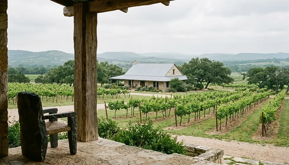
A Hill Country map shows the network of small German-heritage towns, rivers, and wineries spread across roughly 25 counties in Central Texas, with Fredericksburg sitting near the geographic and cultural center. Understanding how the region's roads, towns, and waterways connect helps both travelers planning a trip and property owners evaluating where to buy or rent an investment property.
Fredericksburg anchors the western Hill Country, roughly 70 miles west of San Antonio and 80 miles from Austin via US-290, making it a natural midpoint for regional exploration.
New Braunfels and San Marcos sit along the I-35 corridor, connecting San Antonio and Austin and giving those two towns a distinct traffic and demand pattern compared to Fredericksburg's Main Street tourism model.
Fredericksburg wine country short-term rentals average 48% occupancy, according to Short Term Rental Agent Hub, a figure shaped heavily by weekend-versus-weekday demand across the mapped wine trail.
Wine Road 290 runs between Fredericksburg and Stonewall, forming one of the most recognizable corridors on any Hill Country map and a major driver of weekend booking demand.
Property owners who understand the region's geography can price and market rentals more accurately, since proximity to Main Street, the Guadalupe River, or Schlitterbahn changes what a listing can realistically command.
This guide walks through how to read a Hill Country map step by step, from major highway corridors to the towns and natural features that shape short-term rental demand in 2026.
If you're trying to make sense of a Hill Country map for the first time, whether you're planning a weekend trip or scouting an investment property, the region can look deceptively simple at a glance. It isn't. The Texas Hill Country spans a patchwork of counties, rivers, and towns that each carry their own character, permitting rules, and seasonal demand curves.
At Stay In The Heart of Texas, we work with property owners across Fredericksburg, New Braunfels, San Marcos, San Antonio, and Austin, and one of the first things we walk new owners through is exactly how these towns relate to each other on the map. Understanding the geography isn't just a travel-planning exercise. It directly affects how you price a rental, what amenities guests expect, and how far you are from the attractions that drive bookings.
This guide breaks the Hill Country map into its core building blocks: the highway corridors, the river systems, the major towns, and the seasonal patterns that shift depending on where a property sits. By the end, you'll know how to read the region like someone who has spent years managing rentals inside it, not just glancing at a tourism brochure.
What Does the Texas Hill Country Map Actually Cover?
The Texas Hill Country map covers a roughly 25-county region of Central Texas defined by limestone hills, spring-fed rivers, and a cluster of small towns settled largely by German immigrants in the 1800s. The region has no single official boundary, but most maps center it between San Antonio, Austin, and the Llano Uplift to the west.
Fredericksburg sits close to the geographic middle of that footprint, which is part of why it functions as the region's cultural hub. Main Street's mix of German bakeries, wine tasting rooms, and antique shops draws day-trippers from both San Antonio and Austin, roughly an hour and a half drive from each depending on traffic.
Notably, the Hill Country isn't a flat grid of towns. It's built around river valleys, specifically the Guadalupe, the Pedernales, and the Comal, that carve the terrain and determine where towns clustered historically. New Braunfels and San Marcos grew up along the I-35 corridor, while Fredericksburg and Kerrville developed further west along US-290 and Highway 16.
For property owners, this matters because a Hill Country map is really a demand map. Towns along the interstate corridor pull steady weekday traffic from commuters and business travelers, while towns like Fredericksburg lean heavily on weekend leisure demand tied to wineries and festivals. Knowing which pattern your property falls into shapes everything from your minimum-stay policy to your pricing calendar.
How Do You Get From Austin or San Antonio to Fredericksburg?
The most direct route from Austin to Fredericksburg runs west on US-290, a drive that typically takes 80-100 minutes depending on traffic through Dripping Springs and Johnson City. From San Antonio, the drive west on I-10 or Highway 87 typically runs 70-90 minutes.
US-290 is arguably the most important road on the entire Hill Country map for anyone tracking short-term rental demand. It runs directly through Wine Road 290, the stretch between Johnson City and Fredericksburg lined with dozens of tasting rooms. Weekend traffic on this corridor spikes noticeably during spring and fall, and again around festival weekends in downtown Fredericksburg.
From San Antonio, most visitors take I-10 West to Highway 87, cutting north through Comfort and Boerne before reaching Fredericksburg. This route is shorter in distance but can slow considerably on Friday afternoons as weekend travelers head out simultaneously.
If you're coming from New Braunfels or San Marcos, expect roughly a 60-75 minute drive west on Highway 46 or through Boerne, depending on which route you take. This is a detail we walk out-of-state cabin owners through constantly at Stay In The Heart of Texas, since guests booking a Fredericksburg property often ask how far it is from a New Braunfels day trip, and the honest answer is close enough for a day, far enough that most guests plan just one direction.

The Hill Country Map Review I Do Every Summer
Where Do New Braunfels and San Marcos Fit on the Hill Country Map?
New Braunfels and San Marcos sit along the I-35 corridor roughly 30 miles apart, positioned almost exactly between San Antonio and Austin. Both towns anchor the eastern edge of what most Hill Country maps include, and both draw a fundamentally different guest than Fredericksburg does.
Specifically, New Braunfels built its tourism economy around the Comal and Guadalupe Rivers, with Schlitterbahn Waterpark drawing massive summer crowds. As a result, short-term rental demand in New Braunfels spikes hard from Memorial Day through Labor Day, then tapers noticeably in the fall and winter, a very different seasonal curve than Fredericksburg's wine-driven, near-year-round weekend pattern.
San Marcos, just south of New Braunfels, draws a mix of river tubing guests and Texas State University-related visitors, giving it a bit more weekday demand than a purely leisure-driven market. According to a Texas Tech Institutional Repository analysis, New Braunfels posted a growth rate of 25% compared to a countywide growth rate of 50%, a reminder that even towns close together on a map can carry very different growth trajectories.
For an owner deciding where to buy, this eastern I-35 stretch offers a genuinely different investment profile than the western wine country. If you already own in one region and are weighing a second property, this is exactly the kind of comparison our team walks through with owners considering a New Braunfels or San Marcos purchase alongside an existing Fredericksburg property.
What Rivers and Natural Landmarks Should You Know on a Hill Country Map?
The Hill Country's defining natural features are its spring-fed rivers: the Guadalupe, the Comal, the Pedernales, and the Frio, each of which shapes tourism patterns in the towns along its banks. These rivers are what separate the Hill Country from flatter, drier parts of Central Texas on any topographic map.
The Guadalupe River runs through New Braunfels and continues southeast, historically the most popular tubing river in the state during summer months. The Comal River, shorter and spring-fed at a constant cool temperature, runs directly through downtown New Braunfels and feeds Schlitterbahn's original location.
Further west, the Pedernales River cuts through Fredericksburg and Johnson City, feeding Pedernales Falls State Park, a popular swimming and hiking spot that draws a quieter, more nature-focused crowd than the tubing rivers to the east. If you're comparing rental markets, properties near the Pedernales tend to attract families and hikers rather than the younger tubing crowd drawn to the Comal and Guadalupe.
Canyon Lake, formed by a dam on the Guadalupe River northwest of New Braunfels, adds another distinct market to the map entirely, one built around boating and lake recreation rather than river tubing or wine tasting. If you're planning a trip that includes the lake, our guide to the best things to do in Canyon Lake covers the specific spots worth building a day around.
How Should Property Owners Use a Hill Country Map to Choose a Rental Location?
A Hill Country map helps property owners identify demand patterns before buying, since proximity to a specific river, downtown district, or highway corridor directly determines a rental's seasonal occupancy and achievable nightly rate. This is one of the first exercises we run through with new owners at Stay In The Heart of Texas.
Follow these steps when evaluating a location using the map:
Step 1: Identify the Nearest Demand Driver
Pinpoint the single biggest draw within a 10-15 minute drive of the property, whether that's a Main Street downtown district, a river access point, or a winery cluster. A property five minutes from Fredericksburg's Main Street commands a different rate than one 25 minutes out, even within the same county.
Step 2: Check the Seasonal Curve for That Driver
Wine-driven markets like Fredericksburg see relatively steady weekend demand across spring, summer, and fall, dipping mainly in deep winter outside of holiday weekends. River-driven markets like New Braunfels see a sharper summer peak and a real winter lull. Match your revenue expectations to the actual curve, not a generic average.
Step 3: Map the Competing Highway Routes
Look at how guests will actually arrive, whether via US-290, I-10, or I-35, and how that route intersects with festival traffic or weekend congestion. A property that's technically close in miles but sits behind a bottlenecked route can feel farther to guests than the map suggests.
Step 4: Cross-Reference Local Permitting Boundaries
Short-term rental rules vary by city and county across the Hill Country, so the same map that shows you a property's location also determines which jurisdiction's STR ordinance applies. Fredericksburg, New Braunfels, and San Marcos each administer their own permitting processes, and boundary lines aren't always obvious from a standard road map.
Step 5: Factor in Distance to Complementary Markets
Consider whether the property sits close enough to a second demand driver, like a winery cluster near a river town, to capture multi-day trips rather than single-purpose visits. Properties that can plausibly serve as a base for both wine tasting and river time tend to book more consistently across seasons.
Pro tip: Don't rely on driving-distance estimates from a map app alone. Weekend festival traffic on US-290 near Fredericksburg or summer congestion on I-35 through New Braunfels can add 20-30 minutes beyond what a normal traffic-free estimate shows.

What Are the Common Mistakes People Make Reading a Hill Country Map?
The most common mistake is assuming towns that look close together on a map share the same tourism economy, when in practice Fredericksburg's wine-driven demand and New Braunfels's river-driven demand behave nothing alike. Treating the whole region as one uniform market leads to mispriced listings and mistimed seasonal strategy.
A second frequent error involves underestimating drive times during peak season. A route that takes 75 minutes on a quiet Tuesday can stretch past two hours on a festival Saturday in October, when Fredericksburg's Main Street and surrounding wineries see their heaviest annual traffic.
Third, many first-time hosts overlook how county and city lines intersect with the map's visual boundaries. Two properties ten minutes apart can fall under entirely different short-term rental ordinances, one inside Fredericksburg city limits and one in unincorporated Gillespie County, each with different registration requirements.
Finally, out-of-state owners in particular tend to underestimate how much the Hill Country's geography shapes guest expectations. Someone booking a cabin near Fredericksburg is typically looking for a quieter, wine-country weekend, while someone booking near New Braunfels is often planning around river access. Marketing photos and listing descriptions should reflect that distinction, not a generic "Hill Country getaway" pitch that could describe either.
Hill Country Towns Compared: A Quick Reference Table
The table below breaks down how the main towns on a Hill Country map differ in primary draw, seasonal pattern, and typical drive time from Austin and San Antonio, giving property owners and travelers a fast side-by-side reference.
Town | Primary Draw | Peak Season | Drive from Austin | Drive from San Antonio |
Fredericksburg | Wineries, Main Street, German heritage | Spring, fall weekends, holiday season | 80-100 minutes | 70-90 minutes |
New Braunfels | Comal and Guadalupe Rivers, Schlitterbahn | Summer (Memorial Day to Labor Day) | 45-60 minutes | 35-50 minutes |
San Marcos | River tubing, university-area activity | Summer, with steadier weekday demand | 35-50 minutes | 45-60 minutes |
Canyon Lake | Lake recreation, boating | Late spring through early fall | 55-70 minutes | 45-60 minutes |
As shown above, drive times and peak seasons vary enough between these four towns that a single "Hill Country" pricing strategy rarely works well across all of them. This is exactly the kind of market-by-market analysis our team applies when building revenue and pricing strategies for owners across these different pockets of the region.
What Should Travelers Look for on a Hill Country Map Before a Trip?
Travelers planning a Hill Country trip should use the map to identify one primary base town, then plan day trips outward rather than trying to cover multiple distant towns in a single visit. Fredericksburg works well as a base for wine country exploration, while New Braunfels suits river-focused trips.
If your trip centers on Fredericksburg, plan for the drive along the scenic roads around Fredericksburg, many of which connect directly to the wineries along Wine Road 290. Spring brings an added layer of scenery, and our wildflower season guide for bluebonnets near Fredericksburg covers exactly where those blooms tend to cluster each year.
For outdoor plans beyond wine tasting, check local hikes and trails in Fredericksburg before finalizing an itinerary, since several trailheads sit close enough to town to fill a half-day without a long drive. If your trip stretches into the holiday season, Fredericksburg's Main Street takes on an entirely different character, covered in our guide to Christmas in Fredericksburg.
Notably, if New Braunfels museums or cultural stops are part of your plan, our guide to must-see museums in New Braunfels is worth checking before you map out a route, since several sit close enough together to combine into one afternoon.
How Does Hill Country Geography Affect Short-Term Rental Investment Decisions?
Hill Country geography directly shapes short-term rental investment returns, since a property's distance from a river, downtown corridor, or wine trail determines both its achievable occupancy and its seasonal revenue swings. Investors who study the map before buying make more accurate revenue projections than those who buy on price alone.
According to 1st Nationwide Mortgage, Hill Country STR investors who buy right under $500,000 regularly see debt service coverage ratios in the 1.4x to 1.6x range, a figure that depends heavily on whether the property sits in a strong-demand pocket like the Fredericksburg wine corridor or a slower secondary market further from the main attractions.
Real estate investors evaluating a second or third Hill Country property should specifically look at how close a candidate property sits to a proven demand driver versus how much of a discount that distance buys. A property 20 minutes outside Fredericksburg might cost significantly less, but if it also books at a meaningfully lower occupancy, the math doesn't always favor the cheaper purchase.
Based on what we see across our portfolio at Stay In The Heart of Texas, spanning cabins in Fredericksburg and New Braunfels along with out-of-state properties in Arkansas, Oklahoma, and Tennessee, the pattern holds everywhere: proximity to a named, mapped attraction consistently outperforms generic "nearby" positioning. This is precisely the kind of market analysis our STR consulting and advisory service works through with investors before they commit to a purchase.
Frequently Asked Questions
What towns are considered part of the Texas Hill Country map?
The Texas Hill Country spans roughly 25 counties in Central Texas, with Fredericksburg, New Braunfels, San Marcos, Kerrville, Boerne, and Wimberley among its most recognized towns. San Antonio and Austin sit at the region's eastern and southeastern edges and are often included as gateway cities on Hill Country maps.
How far is Fredericksburg from Austin and San Antonio?
Fredericksburg sits roughly 80-100 minutes from Austin via US-290 and roughly 70-90 minutes from San Antonio via I-10 or Highway 87. Both drive times can extend during festival weekends or heavy weekend wine-country traffic.
What river runs through New Braunfels?
The Comal River runs directly through downtown New Braunfels, while the Guadalupe River runs along the town's edge and continues southeast. Both rivers drive the town's summer tubing and recreation economy, distinct from Fredericksburg's wine-focused tourism.
Is Fredericksburg or New Braunfels a better base for a Hill Country trip?
Fredericksburg works best as a base for wine tasting, Main Street shopping, and a quieter weekend pace, while New Braunfels suits travelers prioritizing river tubing and water recreation. Many visitors choose one as a home base and take a single day trip toward the other rather than splitting time evenly.
Do short-term rental rules differ between Hill Country towns?
Yes, short-term rental permitting and registration requirements vary by city and county across the Hill Country, so a property's exact location on the map determines which local ordinance applies. Fredericksburg, New Braunfels, and San Marcos each administer separate STR rules, and owners should confirm specifics with the relevant city or county office.
What is Wine Road 290?
Wine Road 290 refers to the stretch of US Highway 290 between Fredericksburg and Stonewall, lined with dozens of wine tasting rooms. It's one of the most heavily trafficked corridors on any Hill Country map, especially on weekends throughout spring and fall.
How does Hill Country geography affect vacation rental pricing?
A property's proximity to a specific demand driver, whether a downtown district, river access point, or winery cluster, directly affects its achievable nightly rate and seasonal occupancy. Properties near Fredericksburg's Main Street or New Braunfels's river access tend to command stronger weekend rates than similar properties positioned farther from those attractions.
Can I use a Hill Country map to plan a multi-town road trip?
Yes, but plan for one primary base town and treat other stops as day trips rather than moving accommodations each night. Given that drive times between Fredericksburg, New Braunfels, and San Marcos typically run 45-75 minutes, a single well-located base usually works better than constant relocation.
Conclusion: Reading a Hill Country Map With Confidence
A Hill Country map is ultimately a demand map disguised as a road map. Fredericksburg anchors the wine-driven western half of the region, New Braunfels and San Marcos anchor the river-driven eastern corridor along I-35, and the drive times between them, typically 45-90 minutes depending on the route, determine how travelers plan trips and how owners price rentals.
Whether you're a traveler mapping out a weekend or an investor evaluating your next Hill Country property in 2026, the towns, rivers, and highway corridors covered here give you the framework to make that decision with real context instead of guesswork. Geography shapes everything from seasonal occupancy to guest expectations, and reading the map correctly the first time saves both trip-planning headaches and costly pricing mistakes.

If you're weighing where a Hill Country property fits into your portfolio, or you already own a cabin in Fredericksburg, New Braunfels, or San Marcos and want a clearer read on how location shapes revenue, Stay In The Heart of Texas can walk through the specifics with you. Our team works across the region's map every day, and we're glad to talk through what your property's location means for pricing, seasonality, and long-term performance.
Written by Rashmi Bhat, Owner & Operator at Stay In The Heart of Texas


Comments